If you're planning on staying at YHA Brecon Beacons or YHA Brecon Beacons Danywenallt, why not download a free map and get out exploring?
All our self-guided walks start and end at a YHA hostel and are graded so that you can explore the area at your own pace.
From YHA Brecon Beacons:
Craig Cerrig-gleisiad and Fan Frynych
A great little mountain route with a bit of scrambling and stunning views
Moderate route (PDF, 0.9MB)
3.2 miles, takes 2h - 3h
Twyn Dylluan-ddu and National Park Visitor Centre
A gorgeous lowland route to the National Park Visitor Centre and back along the Taff Trail
Moderate route (PDF, 1MB)
8.4 miles, takes 4h - 6h 30m
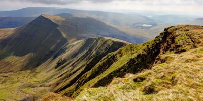
Pen y Fan
A great walk up the highest British peak south of Eryri (Snowdonia)
Challenging route (PDF, 1MB)
8.2 miles, takes 4h 30m - 7h
From YHA Brecon Beacons Danywenallt:
Talybont-on-Usk
A lovely route to the pretty canal and village of Talybont-on-Usk
Moderate route (PDF, 0.7MB)
3.9 miles, takes 1h 45m - 3h
Tor y Foel
Great views from summit of Tor y Foel. Charming stone bridges over the picturesque canal
Challenging route (PDF, 1.1MB)
6.3 miles, takes 3h 30m - 5hr 30m
Twyn Du and Graig Fan Las
A lovely high edge route finishing with a long gentle descent through woodland
Challenging route (PDF, 1.3MB)
13.3 miles, takes 7h 15m - 11h 30m
All our walking routes are tried and tested to help you explore this beautiful part of Wales. To assist with route selection and planning, you’ll also find a description of the hazards and facilities, accessibility information and points of interest on the maps
Discovering Britain walk with the Royal Geographical Society: One Place, Two Identities


