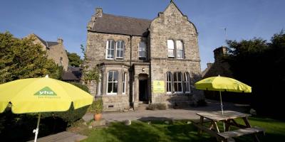
YHA Hathersage
-
WiFi
-
Free parking on premises
-
Restaurant

If you're planning on staying at YHA Hathersage, why not download a free map and get out exploring?
All our self-guided walks start and end at a YHA hostel and are graded so that you can explore the area at your own pace.
Derwent Valley
A lovely walk along the River Derwent.
Moderate route (PDF, 1MB)
2.9 miles, takes 1h 15m - 2h
Stanage Edge and High Neb
A walk leading through meadows and natural woodland to the cliffs of Stanage Edge and High Neb.
Challenging route (PDF, 1.1MB)
7 miles, takes 3h 15m - 5h 30m
White Edge and Froggatt Edg
A full day walk featuring popular gritstone edges of the Peak District and retuning through lowland meadows along the river Derwent.
Challenging route (PDF, 1.3MB)
13.5 miles, takes 6h 15m - 7h 15m
All our walking routes are tried and tested to help you explore this beautiful part of England. To assist with route selection and planning, you’ll also find a description of the hazards and facilities, accessibility information and points of interest on the maps
Want to understand more about our maps or develop your walking skills? Here are some useful guides we have created to help you to prepare for your chosen walk

WiFi
Free parking on premises
Restaurant